2012 Perseid Meteor Shower Peaks This Weekend!!!

Perseid Meteor falling over the Pacific Ocean south of Hilo

The Perseids are here! As seen on National Geograhpic’s website. Every year we enter a swath of debris from Comet Swift-Tuttle sparking these “falling stars”.  Last year was a  bust with a full moon washing out all but the brightest ones.  As pictured below..
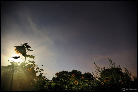
Perseid Meteor and Full Moon 2011

Perseid Meteor and Full Moon 2011

 Unlike last year, this year should be much better. The moon rises in the early morning as a crescent which is better than the bright full moon.  The best place watch is away from city lights where the light pollution takes over our night sky. Where ever you live just take a 30 minute drive out-of-town. This year we have a bonus!  Venus and Jupiter will align with the slender crescent moon in the eastern sky before sunrise in a dazzling morning sky show with a flurry of Perseid Meteors!  The best time to look is between 1am and 4am (NE) when the radiant is the highest in the sky. featured below…

Perseid Sky Map

 I have had the honor of photographing this meteor shower multiple times from many places. Last year I photographed it from Utah, Arizona and Pennsylvania and I’m planning on extending that streak to a couple additional states this weekend. Here are a few shots from past meteor showers.Perseid Meteor over the Utah Desert 2011.

Utah Desert 2011.Delta Aquarid - Glacier 2008

Delta Aquarid Meteor Shower 2008

Quadrantid Meteor Shower 2012

Quadrantid Meteor Shower 2012

Quadrantid Meteor Shower – Florida Keys

Perseid Meteor Shower

Perseid Meteor Shower 2010

Perseids – Big Island of Hawaii
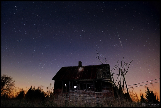
Leonids 2011

Leonids 2011

Leonid Meteor Shower – New Jersey 2011

Volcano and Perseid Meteor 2010

Volcano and Perseid Meteor 2010

The Kilauea Volcano Caldera, the Milkyway and a Perseid Meteor , Hawaii

Lyrids 2012

Lyrids 2012

Lyrid Meteor Shower 2012 – Virginia

Quadrantids in the Florida Keys 2012!

Quadrantids in the Florida Keys 2012!


 On a single night of the year you can see a falling star, but there are nights where the chances increase by a ton!  The Perseids start in late July and last until  about the 18th of August, the greatest activity of the shower will occur this weekend so be sure to go outside tonight and make a few wis

You can see these meteors in any direction in the sky. Make sure you bring a camping chair or blanket and look straight up without focusing on any single area in the sky. If you choose to photograph the shower make sure you use a lens which can cover a good portion of the sky and bring lots of snacks! Try not to look at cell phones or use flashlights that aren’t “red lights” this damages your night vision. When you first arrive at your sight make sure you allow 10-15minutes for your eyes to adjust to the night sky. Do not look at or into any light sources, it will tak you another 15 minutes for your eyes to adjust into (night mode).

Check back for a follow up to the shower and happy meteor hunting!

FORCES OF NATURE: Volcanoes (Hawaii)

The Big Island of Hawaii is a place where new earth is created and taken away on a daily basis. On this island you will encounter several ecosystems and microclimates. A microclimate is the climate of a small, specific place within a larger area. Places such as your back yard, National Parks, or Islands can have many microclimates depending on the sunlight, shade, altitude, exposure to the wind, or lack there of etc. I remember one day sweating in 90 degree heat, with little wind, while photographing a cactus on the west side of the island. Later that day, I was in an Arctic Parka over 13,000ft with  40mph winds, making it feel like 15 degrees. The big island still remains a wilderness and depending on where you are traveling and how far your ambitions for adventure take you, it is possible you may never leave this island. 

Here are some photos from the Big Island of Hawaii. 

Puʻu ʻŌʻō (often written Puu Oo), pronounced “poo-oo oh-oh”, a cinder / spatter cone, is located on the eastern rift zone of the Kilahuea Volcano. Puʻu ʻŌʻō has been erupting continuously since January 3, 1983, making it the longest lived rift-zone eruption of the last two centuries.

Saddle Road / Route 200 traverses the width of the Island of Hawaii, from downtown Hilo (East) to its junction with Hawaii Route 190 near Waimea (west). In May of 1849, G.Judd proposed building a road between these two populated areas. After 10 years,  12 miles of road was completed. The eruption of Mauna Loa in 1859 caused the workers to abandon the site. In the wake of the attacks on Pearl Harbor, the U.S Army built a poor access road in 1943 strictly for military vehicles of all kinds. After WW II the government handed over the road, which was eventually renamed Rt.200. The last lava flow that covered Saddle Road was  in 1984 when the Mauna Loa eruption was triggered from an eruption at Kilahuea.

In the photo above: You can see the newly paved (in spots) Saddle Road from it’s most recent lava flow. Mauna Loa continues to erupt every 8-10 years, and is due for another eruption any day now.

I probably saw at least 50 rainbows in Hawaii during my 2 week stay on 3 islands. I am standing in a desert lava field when I took this photo.  The rainbow marks the spot of another microclimate.

Mauna Kea is a dormant shield volcano, and if measured from it’s oceanic base, Mauna Kea is over 33,000 feet tall, much higher than Mount Everest. Mauna Kea is over 13,700 above sea level. In Hawiian mythology, some say the peaks of the island of Hawai’i are sacred, and Mauna Kea is the most sacred one of all. Mauna  Ancient Hawaiian law allowed only high-ranking tribal chiefs to visit it’s peaks. Today some people seem to disregard that law. In this photo you don’t see a mountain in the background, it’s the shadow of Mauna Kea as the sun sets in the West. Talking about shadows of Mountains… try living in this one. With little oxygen at its summit, unhealthy, overweight, and people that have been scuba diving within 24 hours are advised to find another adventure.

Mauna Kea’s summit is one of the best sites in the world for astronomy because of its high altitude, dry environment, and stable airflow. The access road to the summit was completed in 1964 and since then thirteen telescopes funded by eleven countries have been constructed at the summit.

Astronomers of all levels converge on the slopes of Mauna Kea to catch a glimpse of our universe from an unparallel location.

This Lava flow was the first to have burned down a home on the island in over a decade.  The flow started at the end of July 2010 amd was heading east towards the Kalapana Gardens subdivision. More than one house was burned to the ground including a church. This is the biggest Lava flow they have seen in ages! Timing is everything.

The Puhi-o-Kalaikini ocean entry, which is almost 1 km (0.8 mi) long, continues to feed the ocean after first reaching the pacific in July 2010. This photo is taken from a boat about 15feet or less from the actual entry point. I must admit it was hot, steamy, and a hell of a good time… most likely the most insane thing ever! Strong sulfur dioxide odors can be found in the plumes from both ocean entry and the Kilauea Caldera. Sulfur dioxie fumes may reach such dangerous levels that the National Park, which sits in the middle of it all, will close and evacuations are put into place.

 Kilahuea Caldera, Milkyway, and a Perseid Meteor. Taken during the Perseid Meteor shower in August 2010.

Hope you enjoyed some of my photos! I know I enjoyed creating them!

*Some facts and information found at wikipedia

Haleakala: House of the Sun

 Haleakala sits quitely on the Hawiian Island of Maui. The summit of Haleakala rises to 10,023ft and it is the highest point on Maui. If you were to  measure Haleakala from it’s base at the bottom of the ocean floor,  it measures an incredible 25,000+ feet.  Area: Haleakala Crater measures 19 sq. miles and is over 3,000 feet deep. Many trails lead into the crater and there is also back-country camping inside the crater. (Make reservations 1 year in advance!)

The view into the crater is spectacular from either summit overlook. The best way to explore the crater is to get right in the middle of it.

As whaling began to die in Lahaina in the mid 1860’s, a new industry arose to take its place – sugar. This island once thrived off of sugar, now where plantation camps stood, and families once carved out their lifestyle, modern subdivisions now stand. It’s a shame to see building blocks of the past crumble in the wind.